Project Description
Riverlife, in the process of planning for the adjacent West End Bridge Connector, learned that PennDOT owned a defunct rail corridor in the West End Village, which could help to connect communities in West and South Pittsburgh to the wider trail systems and the rest of the City. As a first step, the City is working with Riverlife and Friends of the Riverfront to study the feasibility of constructing a multimodal trail along the full corridor and develop alternatives for a broader network of trails in the West End.
The proposed trail network would stem from a 2.25-mile spine running from West End Bridge to Crane Avenue along Saw Mill Run in Pittsburgh’s West End. The basis of this route is the former Pittsburgh and West Virginia railroad corridor, which is now owned by PennDOT. PennDOT has no plans for this property, and they are open to dispensing of the parcels, preferably to another public owner.
At minimum, spurs could run to the Trolley Trail along McCartney Street (currently in construction), across Saw Mill Run Boulevard to Emerald View Park and the Wabash Tunnel, and into Seldom Seen Park. This network could also connect to existing and proposed regional trails like theGAP trail, Great American Rail Trail, Montour Trail, Panhandle Trail, and others.
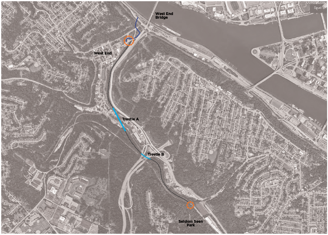
The proposed trail would utilize re-purposed railroad trestles to create access across steeply sloped areas between the West End and Crane Avenue to connect with the Seldom Seen Park.
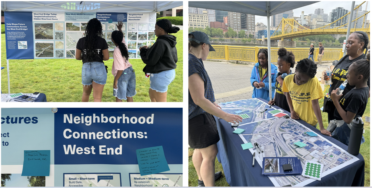
The project partners selected a team led by Toole Design, many of whom are also working on the West End Bridge Connector Project, to conduct this analysis. We have collected input from residents and visitors about desired connections, experiences, and opportunities along this corridor, which has guided plans to improve pedestrian access to the trails.
Public Engagement
Input about these changes was collected to guide the design process. Scaled interventions were proposed to participants who provided feedback about their experience walking across the West End Bridge. This expansion of the West End Bridge Connector project allows planners to envision how residents could access the trail local and regional trail network the Saw Mill Run Connector seeks to link with the Three Rivers Heritage Trail.