Project Updates
Final Plan Released
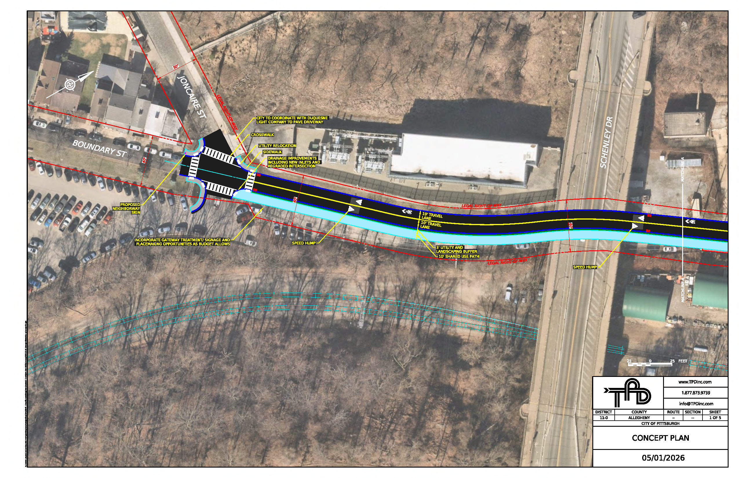
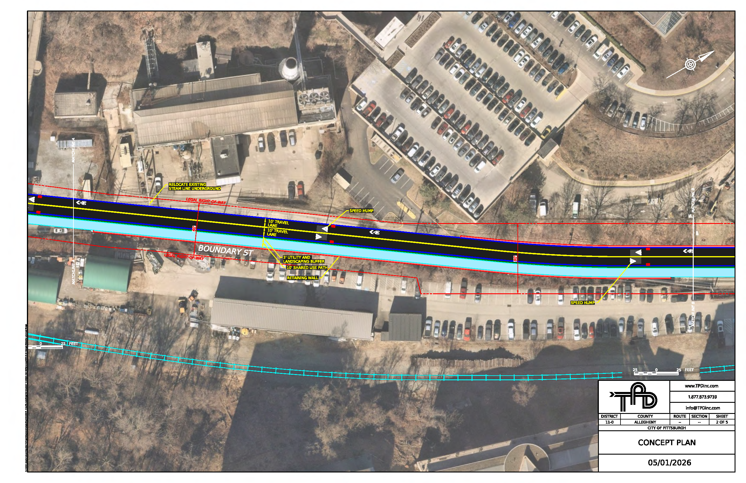
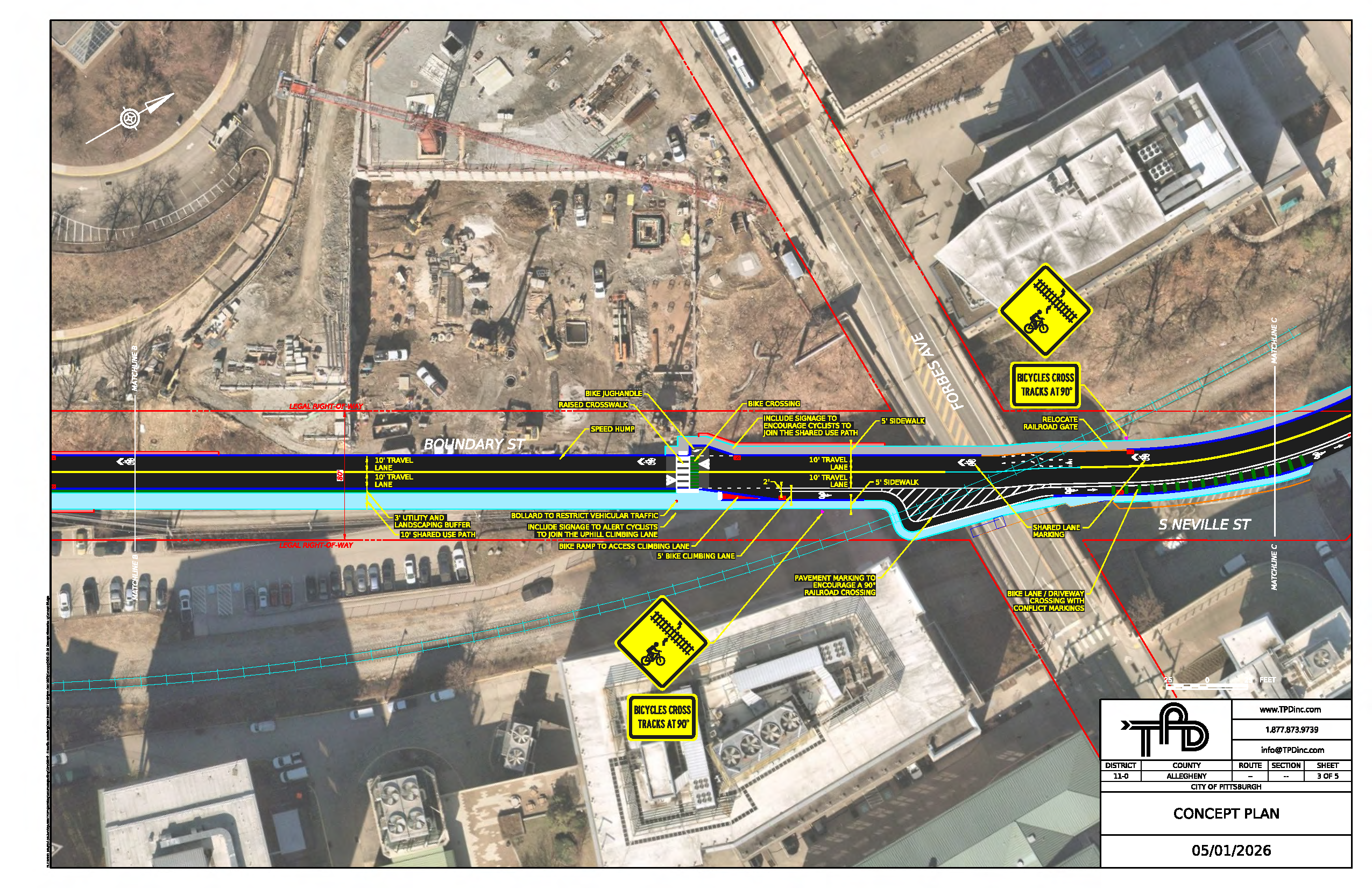
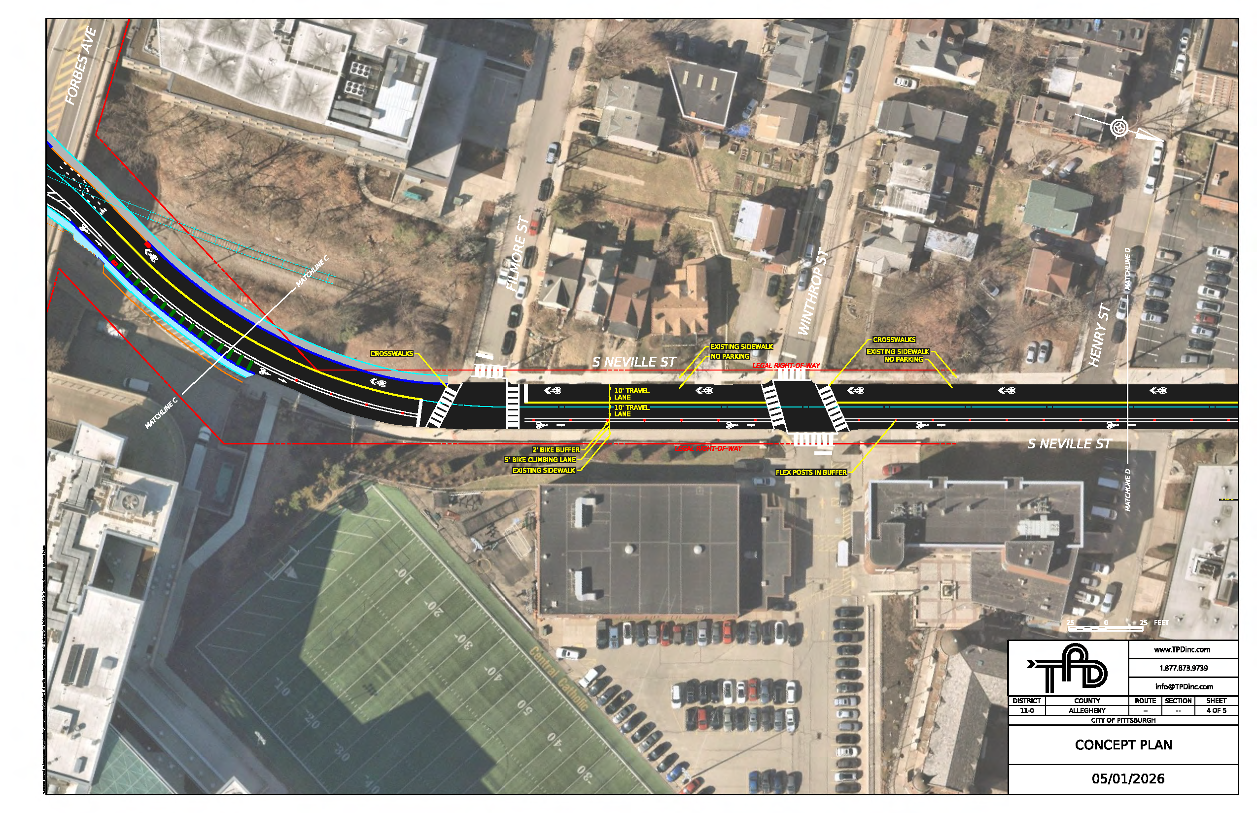
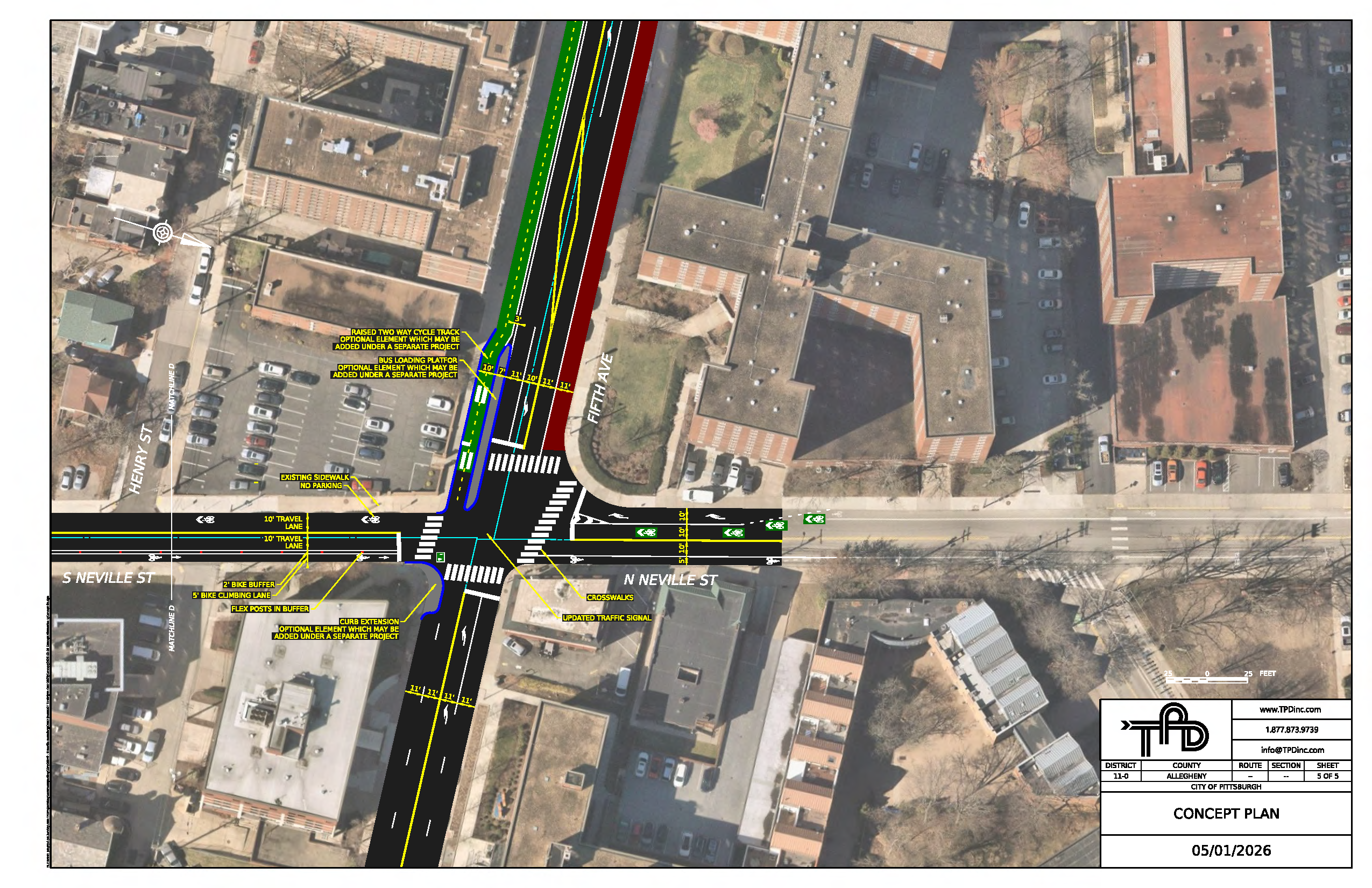
The final plan document for the corridor has been released to the public and is available to view! Click the cover sheet below to open the plan. The plan and schematics are also available for download in the Document Library on this page (on desktop view, this is on the right side of the page).
What Happens Next?
Now that the plan has been completed, the City will use it to pursue various funding opportunities for implementation. Once funding has been secured, a new EngagePGH Page will be launched to kick off the implementation project.
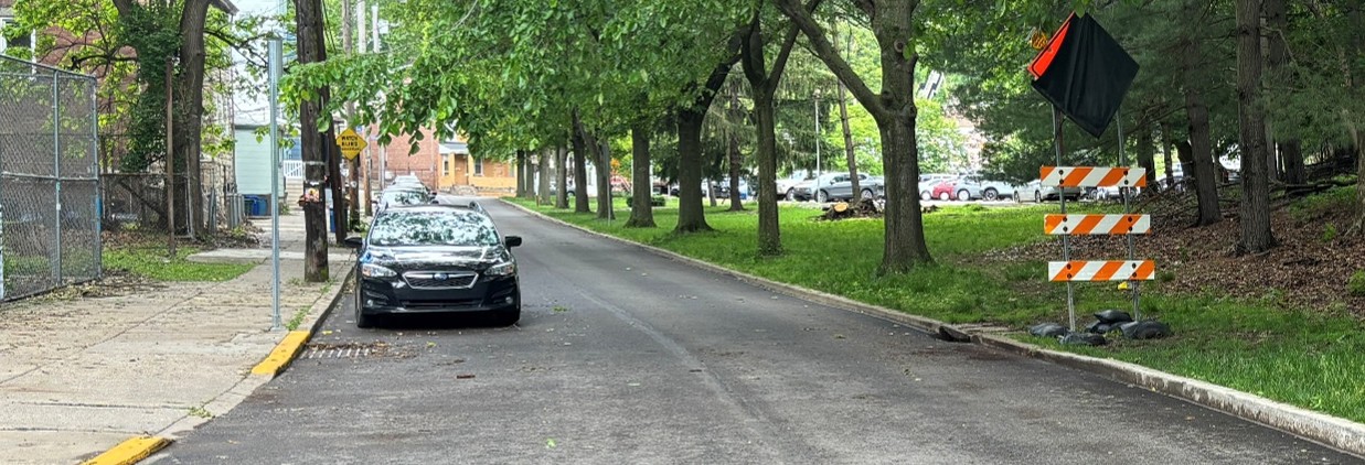
Image 1 of 5
Project Background
Boundary St. / S Neville St. is a vital connection in Pittsburgh's Oakland neighborhood.
Proceeding south from Fifth Ave., S Neville St. descends a ravine with steep slopes on either side, eventually reaching the Panther Hollow section of Oakland. At the corridor's southern end, Boundary St. connects to the Junction Hollow Trail, which provides pedestrian and cycling access to Schenley Park, the Four Mile Run neighborhood, and the Three Rivers Heritage Trail system.
In addition
to these important connections, the corridor hosts institutional, residential, and industrial sites. These
connections and sites attract many pedestrians, cyclists, and motorists.
Why This Corridor Needs a Safety Plan
Despite this corridor's significance to all Oakland residents and students, it lacks a safe connection for pedestrians and bicyclists. Additionally, aggressive driving and speeding pose safety hazards for motorists.
Through past planning efforts including The Oakland Plan led by the City's Planning Department, the community has identified that the Boundary / S. Neville corridor requires improvements to create a safe multimodal connection from Fifth Ave. to the Junction Hollow Trail.
DOMI, in collaboration with the surrounding community and frequent users of this corridor, is developing a streetscape plan to address traffic concerns and ensure safe accommodation for all modes of travel.
Project Study Area

Plan Scope
This plan did:
- Identify speeding concerns and opportunities for pedestrian safety, bicycle connectivity, and streetscape improvements along Boundary St. / S Neville St. from Fifth Ave. to the Junction Hollow Trailhead
- Develop an implementable, safe, and accessible design for the corridor
- Create cost estimates for the designed project
This plan does not:
- Ensure funding or the city’s commitment towards immediate implementation of the designed project
- Identify transportation projects beyond the scope of the plan
Project History
Engagement Phase 3
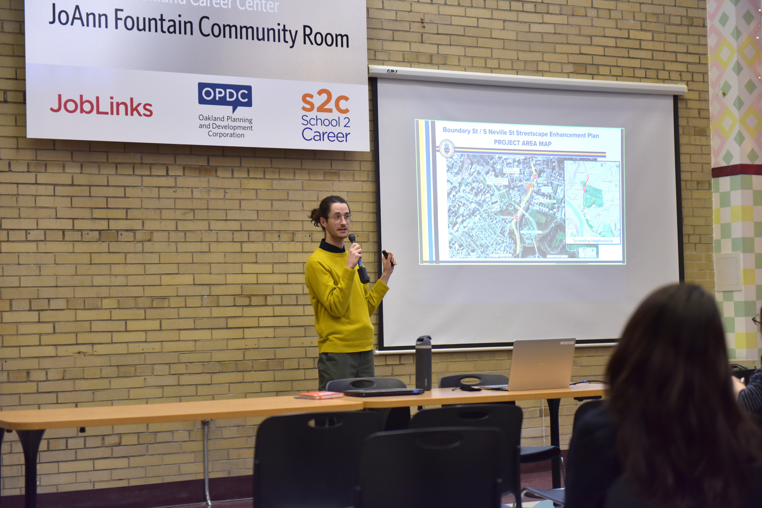
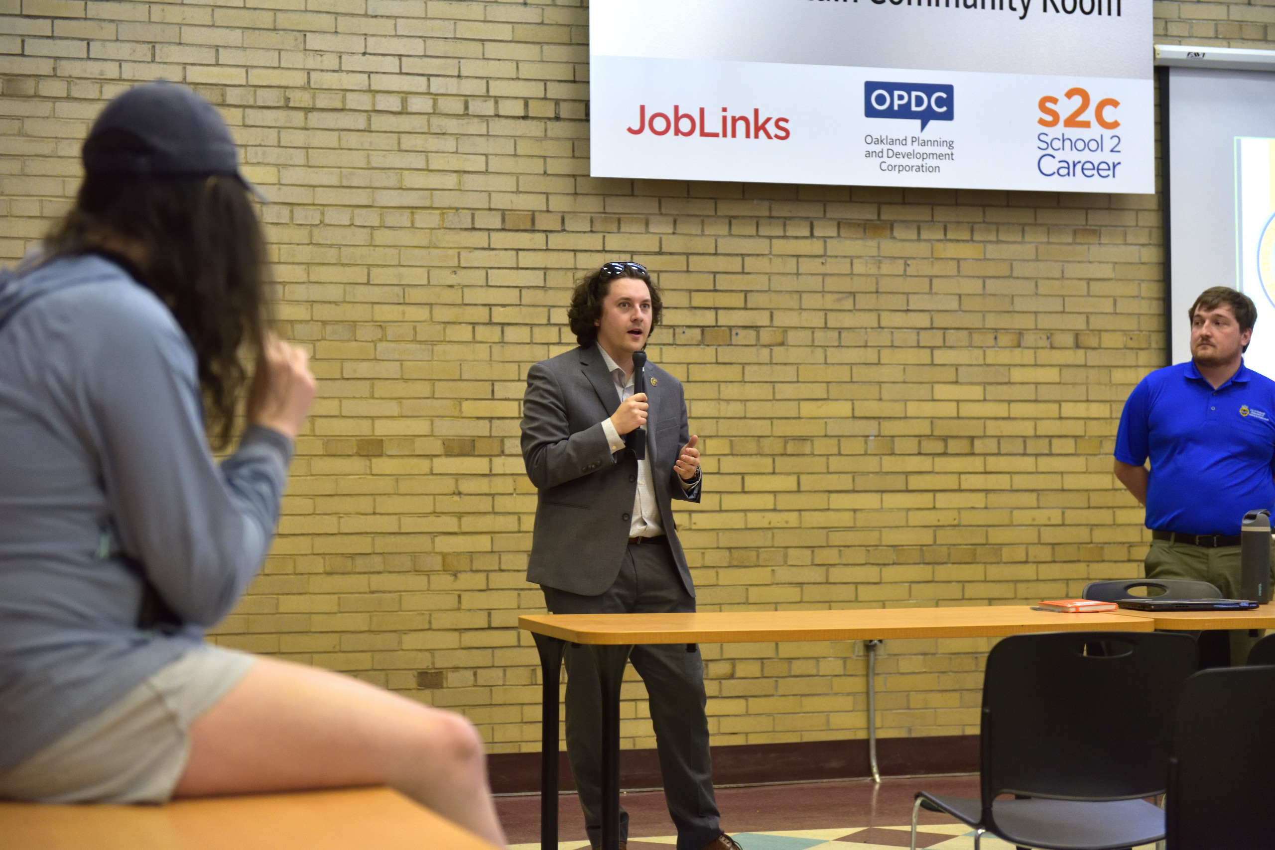
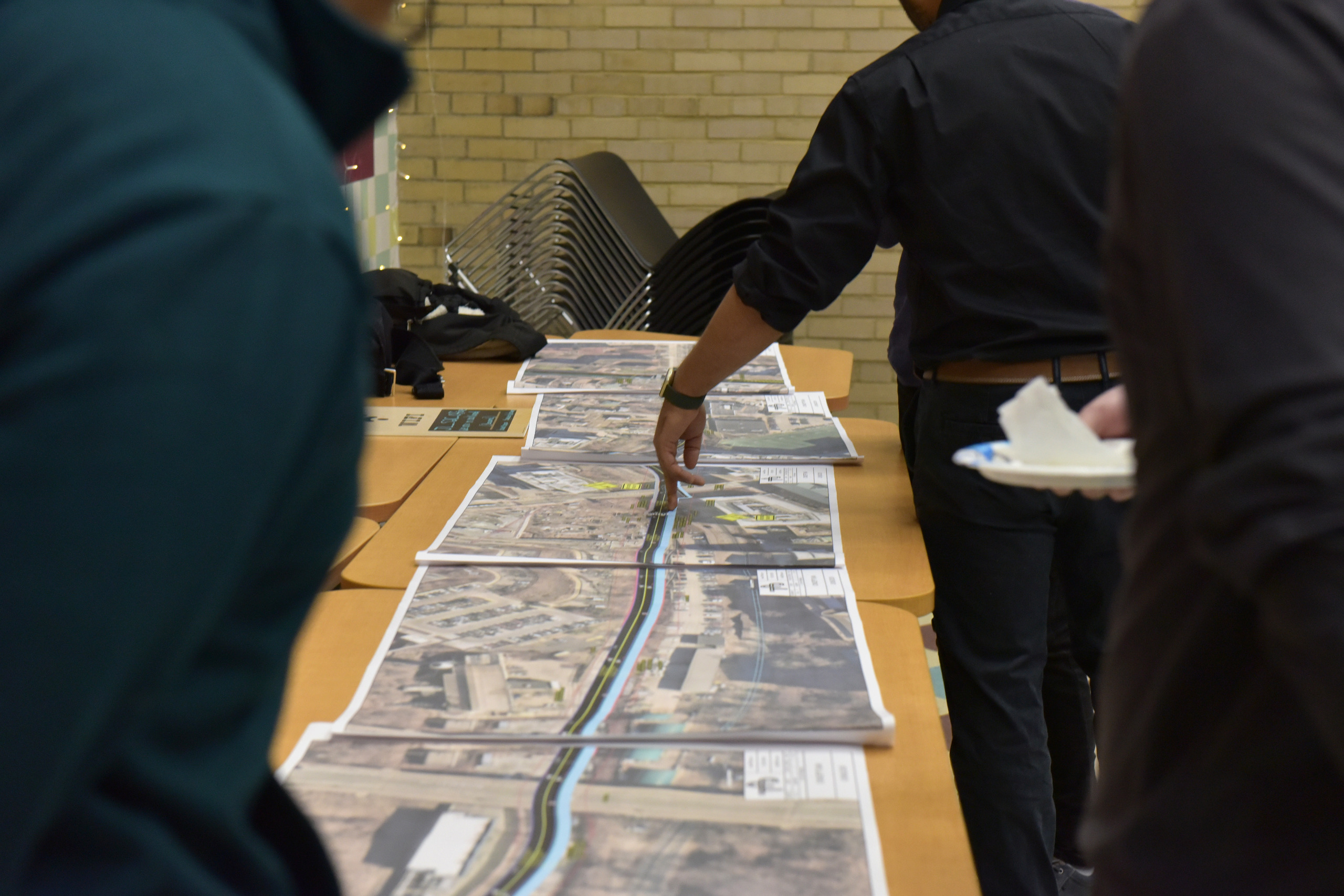
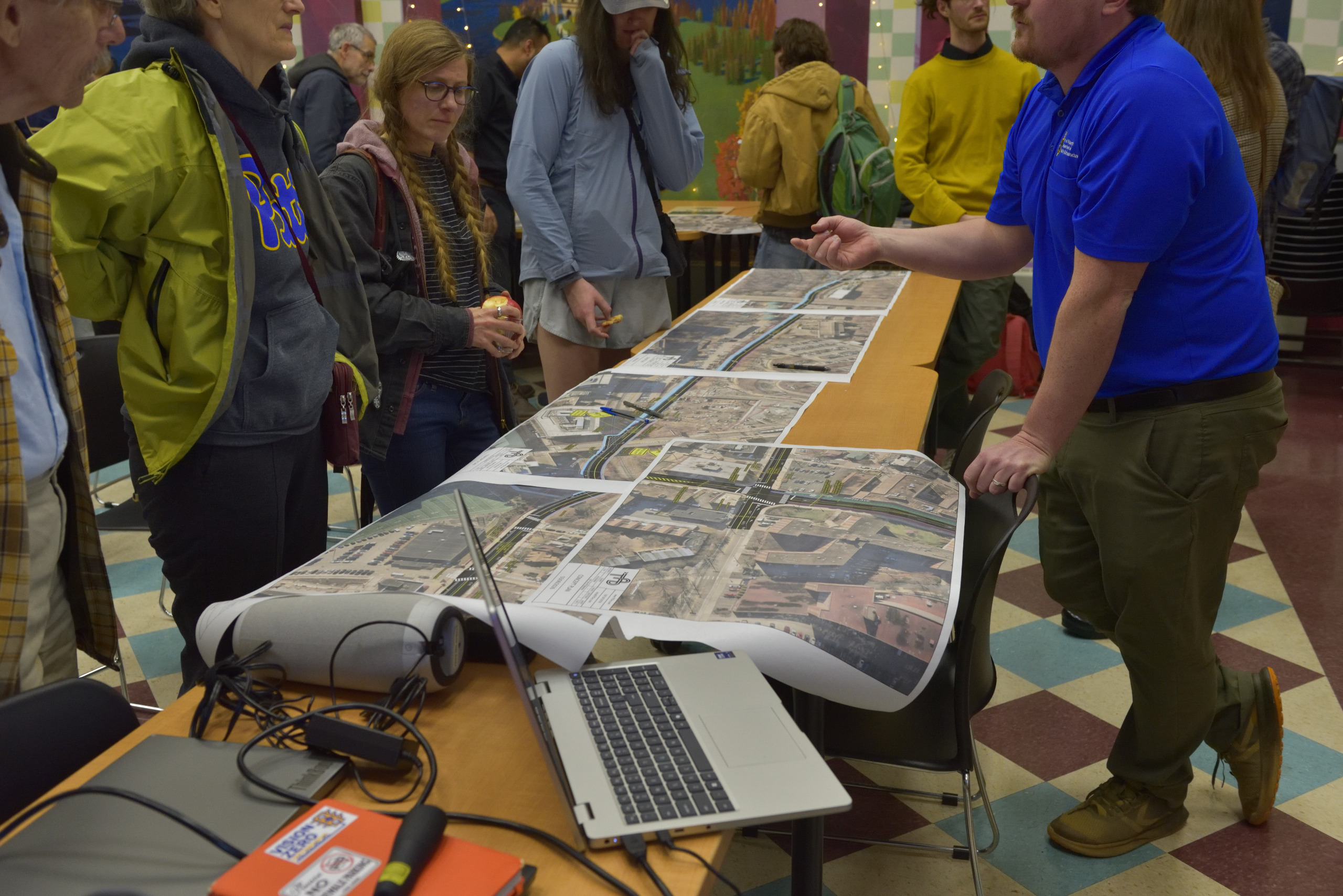
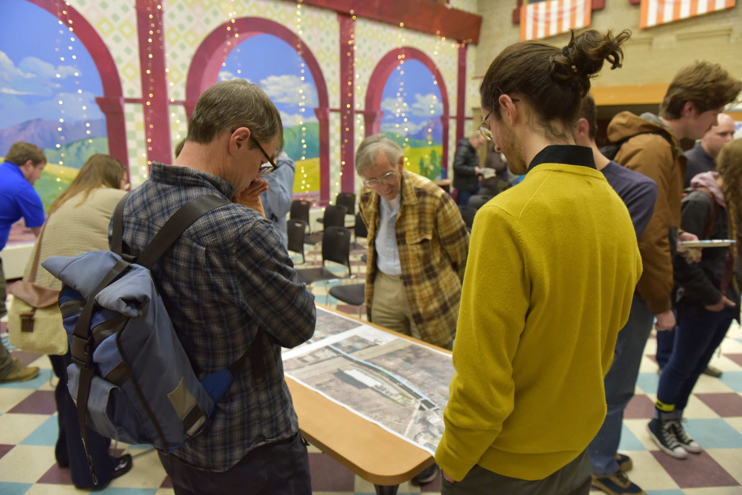
On March 17th, 2026, a draft of the plan was released to the public. The Department of Mobility & Infrastructure (DOMI) held a public meeting on March 25th, 2026 at Oakland Planning and Development Corporation's office to share the plan and its findings. DOMI shared design recommendations for the corridor and the 5th Ave and Neville intersection. This meeting was an opportunity for neighbors and community members to ask questions and provide feedback. In-person and virtual attendance options were available.
The meeting was recorded, and a video is available on this page.
The slides and materials that were presented are available to view in the Document Library on this page.
After the public meeting, an online survey collected additional public feedback on the draft plan until April 8th, 2026.
Engagement Phase 2
On October 28, 2025, the project team at DOMI, the Office of Neighborhood Services, and the project team consultants held a community meeting at the Cohon University Center on the CMU campus.
The project team discussed the history of the corridor, the safety issues reported by users of the corridor, and the proposed alternatives that had been designed based on the feedback received from community input during Engagement Phase 1.
A recording of the meeting can be viewed by clicking below. The slide deck can be viewed and downloaded by visiting the "document library" section on this page.
In-person and online feedback from the community during Engagement Phase 2 informed the planning team's proposals in several ways.
The parking removal proposed for S Neville from Fifth to the railroad was identified as an area of concern due to limited parking availability for permit holders in RPP Zone Q. This led the team to undertake a parking study of RPP Zone Q to find ways to minimize impacts.
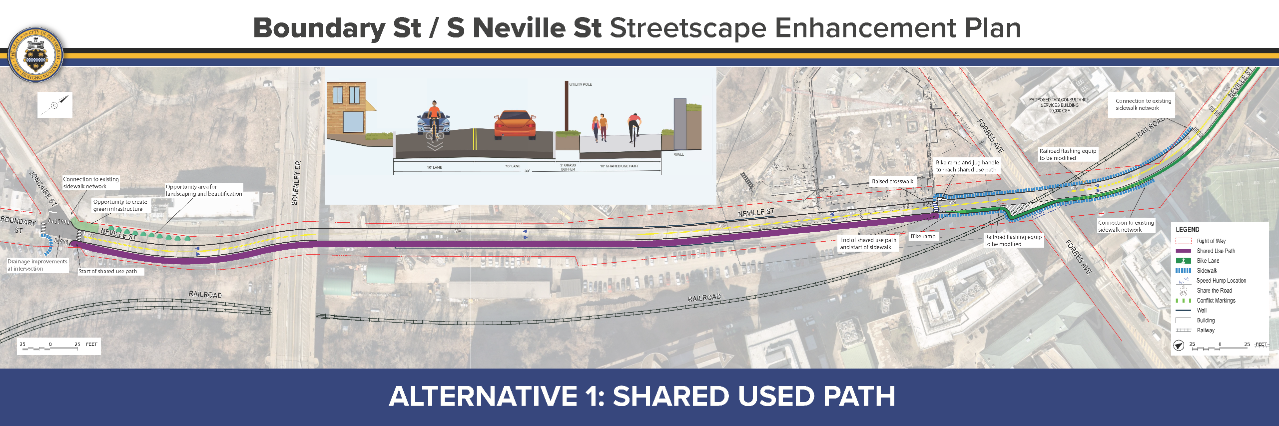
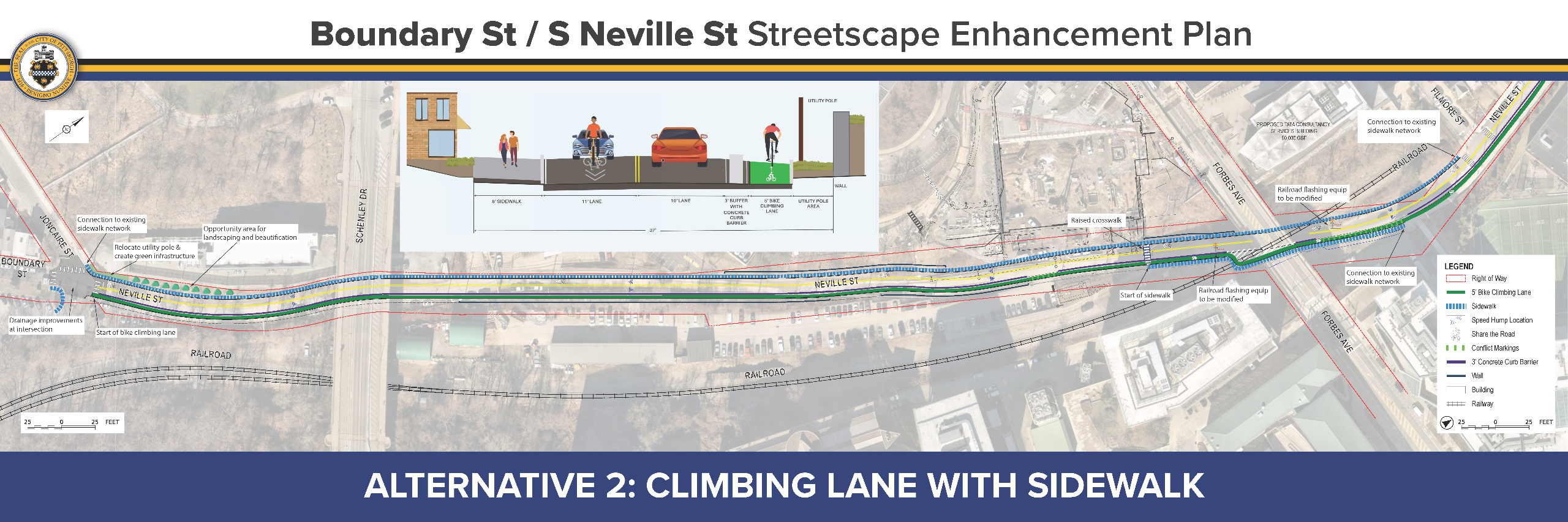
For the segment between the railroad crossing and Joncaire, two alternatives were presented. Conversations with the community at the October 28 public meeting indicated that there was strong community interest in both alternatives. The 148 comments received via an online survey (which ran from October 10 - November 12) gave the planning team valuable insight into the positives and negatives of both alternatives, but did not reveal a clear community consensus on one alternative over the other.
Given the lack of a clear consensus, the planning team utilized both internal analysis and feedback from the community to assess the alternatives, and ultimately decided to advance Alternative 1 (the shared-use path) as the preferred alternative for this segment.
Given the lack of a clear consensus, the planning team utilized both internal analysis and feedback from the community to assess the alternatives in the five following categories:
- Safety
- Alternative 1 was judged by the team to be slightly safer due to greater separation of pedestrians and cyclists from traffic, but the two alternatives were judged to be very closely matched.
- Intuitiveness
- Alternative 2 was judged to be more intuitive due to fewer needed crossings and alignment with the cross-section proposed north of the railroad.
- Capacity for High Volumes of Pedestrians and Cyclists
- Alternative 2 was noted to have a higher potential to accommodate high volumes of pedestrians and cyclists due to its greater overall space for those users, but the two alternatives were closely matched in this category as well.
- Maintainability
- Alternative 1 was judged to be more maintainable. Coordination with the Department of Public Works confirmed that the shared-use path in Alternative 1 is less likely to collect debris and can be more easily swept and plowed with standard city equipment than the protected bike lane in Alternative 2.
- Construction Cost
- Alternative 1 has a lower anticipated construction cost. Analysis from the design consultant indicates that Alternative 1 can fit in a narrower cross-section, and therefore will require less earthwork and fewer retaining walls. The consultant estimated that this could mean millions of dollars in cost savings.
Due to the two alternatives' close match in the categories of safety, intuitiveness, and capacity, and the clear victory of Alternative 1 in the categories of maintainability and cost, the planning team came to consensus that Alternative 1 should be advanced as the preferred alternative. The cost savings improve the prospect of securing funding for project implementation, and the ease of maintenance helps to ensure that the corridor will remain safe and usable year-round.
While the planning team believes that the cost savings and easier maintenance of Alternative 1 give it a decisive advantage over Alternative 2, the team also heard important feedback about features the community valued in Alternative 2. Because of this, the project team is exploring ways that some elements of Alternative 2 can be integrated into Alternative 1 where feasible.
Initial Design Proposals
In early October 2025, initial designs for the corridor were released to the public. Corridor analysis and feedback from Engagement Phase 1 were synthesized into the following core design principles:
- Safety & Connectivity: Create a safe, multimodal connection linking 5th Avenue to the park.
- Access & Operations: Retain two-way access along the corridor and ensure CMU loading activities can continue without disruption.
- Feasibility: Minimize earthwork, utility relocation and rail road conflicts to maintain financial feasibility.
- User Experience: Enhance the overall road user experience for all modes of transportation.
- Preservation: Retain and build upon successful existing features, such as current traffic-calming treatments, within the new design.
The initial design proposals are available to view below.
(Please note: some designs have been revised since their initial public release. Refer to the plan document for the most recent proposals.)
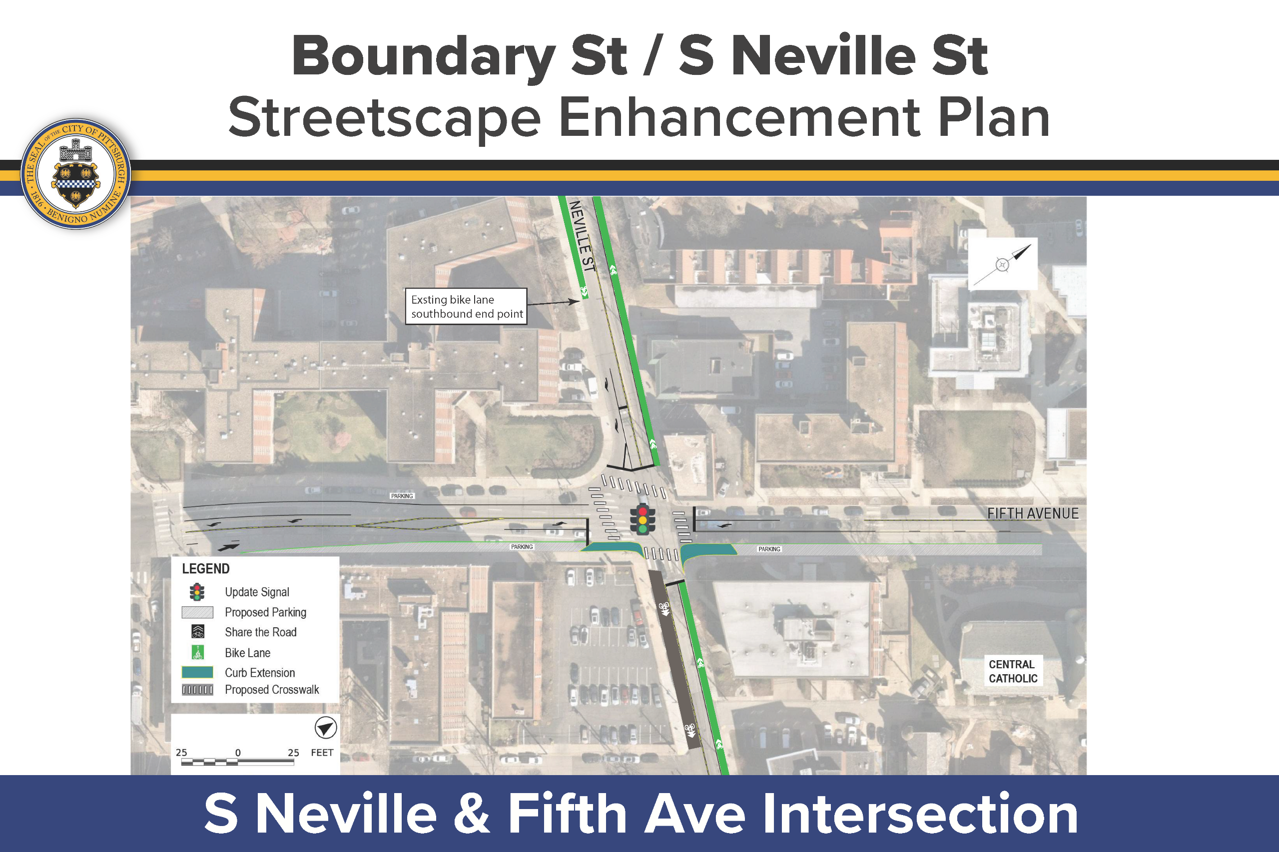
To address the significant crash history at the intersection of Fifth Ave and Neville St, the planning team developed several proposed changes. The following are some of the key changes that were proposed:
Fifth Avenue:
- Add left turn lanes and left turn signal phase
- Add parking/loading
- One travel lane in each direction
Neville Street:
- Add climbing bike lane
- Remove downhill parking and provide shared lane markings
Proposed changes can be viewed below.
From Fifth Avenue south to the railroad crossing, a continuous climbing bike lane was proposed. Where sidewalks are not currently present on both sides of the street, new sidewalks were also proposed to be added. To accommodate these improvements, on-street parking along the western side of S Neville St will need to be removed.
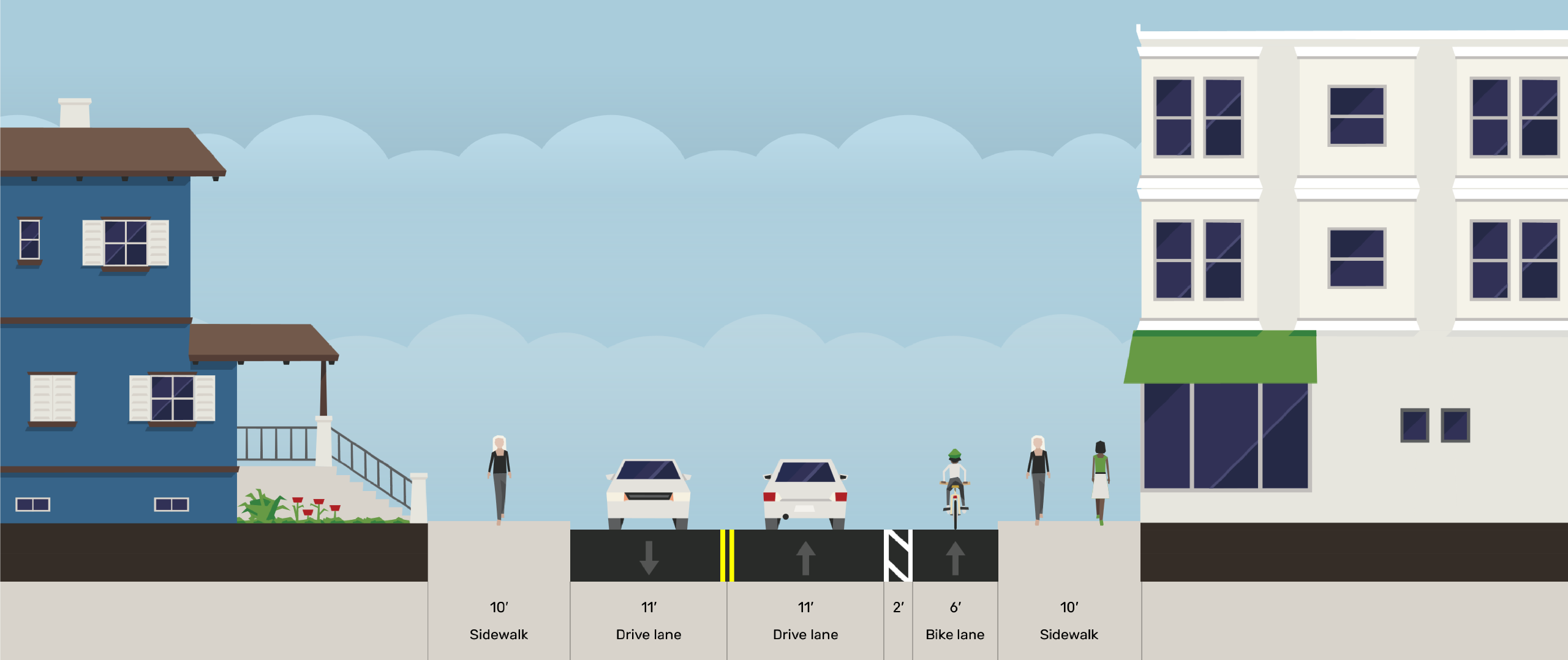
Existing conditions with parking lane on western side of S Neville (view: north/uphill)
Proposed condition with added bike lane (view: north/uphill)
The planning team developed two design alternatives for the section of the corridor between the railroad crossing and Joncaire Street. Each alternative had unique advantages and disadvantages, so both were presented to the public so that the team could receive feedback that may identify a preferred alternative.
Due to the existing low-speed residential context, the stretch from Joncaire St south to the Junction Hollow Trail Entrance was not proposed to have significant changes. Interventions along this stretch of the corridor were proposed to be limited to the city's typical neighborhood traffic calming design treatments.
Engagement Phase 1
The first phase of public engagement was held from February 24 - May 5, 2025. This phase collected feedback from the community about their experiences and issues with the study corridor. During this phase, we received over 400 online comments! A few key statistics about who submitted comments include:
- 45% of commenters said they use this corridor weekly
- 82% of commenters said they cycle on this corridor
- Most commenters said they use the corridor in the mornings and evenings
- Commenters said the following about where they're going when they use the corridor:
- 88% said they are accessing recreational destinations
- 45% said they are going to work
- 11% said they are going to school
What We Heard
Comments highlighted many challenges to safe mobility on the corridor. Here are some of the key challenges that we heard about:
- Steep grade and narrow roadway
- Lack of safe pedestrian route
- Drainage issues, potholes, and debris
- Disconnected bike infrastructure
- Hazardous skewed railroad crossing
- Poor lighting
- Overgrown vegetation
- Speeding and aggressive driving
Community Walkthrough
On April 22, 2025 the project team conducted a walkthrough of the corridor with representatives from community stakeholder groups.
In attendance were representatives from Central Catholic High School, University of Pittsburgh, Carnegie Mellon University, Carnegie Museums of Pittsburgh, the Bellefield Boiler Plant Consortium, Oakland Planning and Development Council (OPDC), the Oakland Transportation Management Association, BikePGH, City Council Districts 3, 5, and 8, as well as staff from DOMI and the Department of City Planning.
What We Heard
On the walkthrough, we discussed issues including:
- Speeding
- Pedestrian and cyclist safety
- Loading and delivery operations
- Student pick-up and drop-off
- Current and upcoming institutional development plans adjacent to the corridor
- Right-of-way ownership
- Drainage concerns


Corridor Traffic Data
The planning team collected vehicle counts and speed data in March of 2025 to help guide the design process.
| Corridor Length | 2780 ft (0.53 miles) |
| Average vehicles per day | 3,370 passenger vehicles 150 trucks 120 bikes 3,640 total |
| 85th percentile speed | 25.4 mph (25 mph speed limit) |


