Riverlife, a nonprofit committed to improving the City of Pittsburgh riverfronts, is investing more than $2 million in design and engineering to create accessible and equitable connections leading to the historic West End Bridge. Riverlife has partnered with architects Merritt Chase and a multidisciplinary team of experts for this transformational project.
This project is a collaborative effort between the City of Pittsburgh, Pennsylvania Department of Transportation (PennDOT), Allegheny County Sanitary Authority (ALCOSAN), and other partners. The projects are supported by the Redevelopment Authority of Allegheny County Trail Development Fund and the PA Dept. of Conservation and Natural Resources.
Project Description
The West End Bridge is the first crossing over the Ohio River just downstream from the City of Pittsburgh. The bridge is the western-most portion of a 15-mile trail system and open space area around Pittsburgh’s downtown. Through a series of projects, the City and its partners aim to connect the West End and Manchester neighborhoods while enhancing the City's waterfront.
This project includes a series of related projects which are best characterized in 2 parts.
- The West End Bridge Connector: will bring ADA accessible bike and pedestrian ramp structures to the West End Bridge from Manchester and the West End Neighborhoods. The project also explores access into the neighborhoods and will improve sidewalk and street level approaches in Manchester and the West End Village.
- The Saw Mill Run Connector: will explore the feasibility of further trail development along Saw Mill Run
Theses projects are also key to bigger planning efforts like the West Pittsburgh Mobility Study and Manchester Reunited, an effort to convert State Route 65 into an at-grade boulevard, reconnecting Manchester and Chateau.
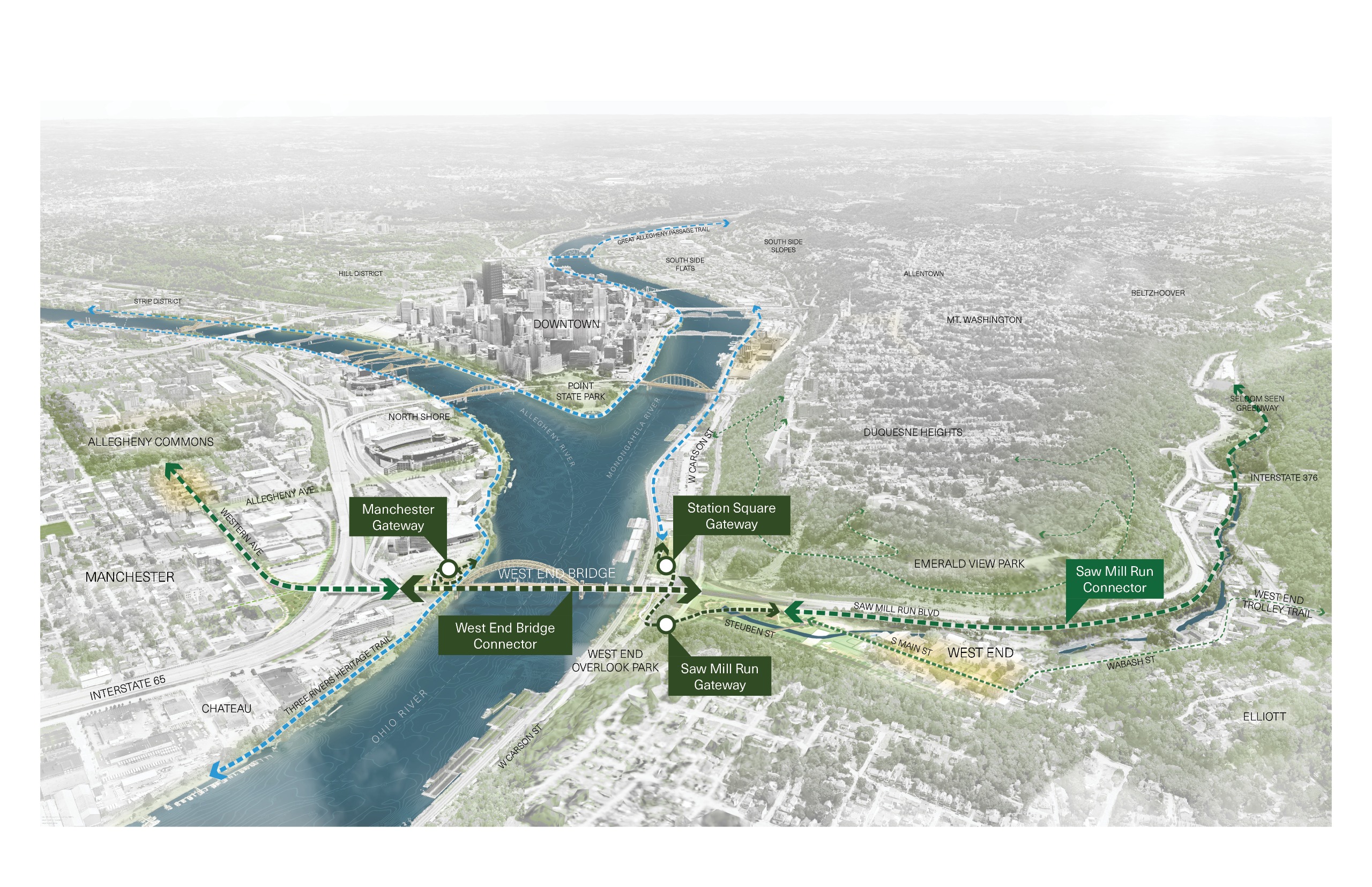
Riverlife's service area includes the riverfront throughout downtown Pittsburgh between the 31st Street, Hot Metal and West End Bridges. These projects address one of the biggest gaps in "The Loop", Riverlife's vision of a continuous 15 mile loop of ADA accessible trails.
West End Bridge Connector: The West End Bridge stands as an iconic gateway to Pittsburgh and its rivers, but the actual connections to it from riverfront and community are limited and unpleasant. The West End Bridge Connector is an ambitious, neighborhood-linking project that will transform the way people experience and interact with this vital crossing. Founded on a seamless network of new multi-modal connections and improved public spaces, with design inspired by the natural beauty of Pittsburgh’s rivers, the project will provide safe, inviting gateways to and across the Ohio for walkers, runners, and cyclists alike.
The West End Bridge Connector includes three distinct gateway projects that connect specific neighborhoods to the riverfront. The gateways include ADA accessible bike and pedestrian ramps and integrated park spaces, as described below:
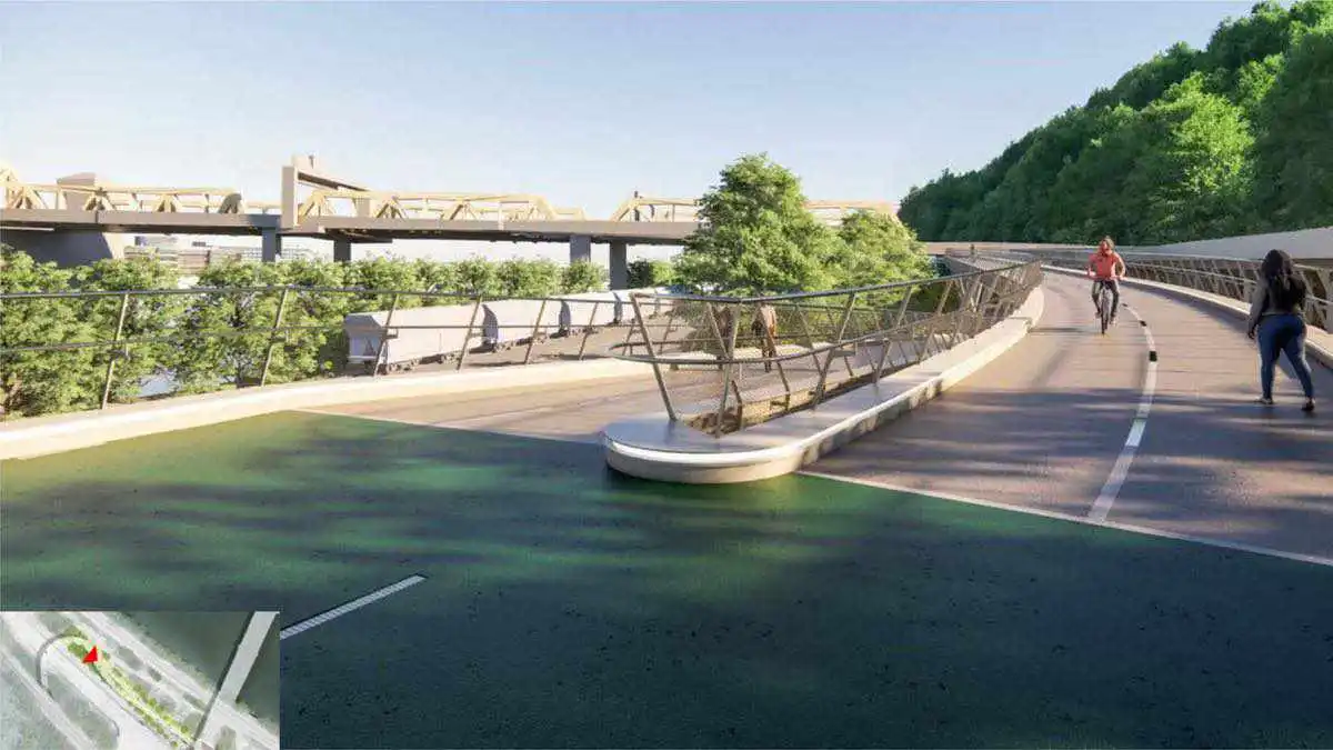
Saw Mill Run Gateway
The Saw Mill Run Gateway would create safer connections to the West End with an access structure and streetscape improvements
The access structure connects the West End Village at Steuben street through a repurposed Railroad Tunnel that crosses Carson Street. Because of the difference in height from Carson Street to the bridge, the ramp has a long approach to meet ADA Accessibility standards and has a switchback at the point where it meets the ramp to the Tunnel.
Neighborhood connections will make accessing the West End Bridge Connector safer and more enjoyable
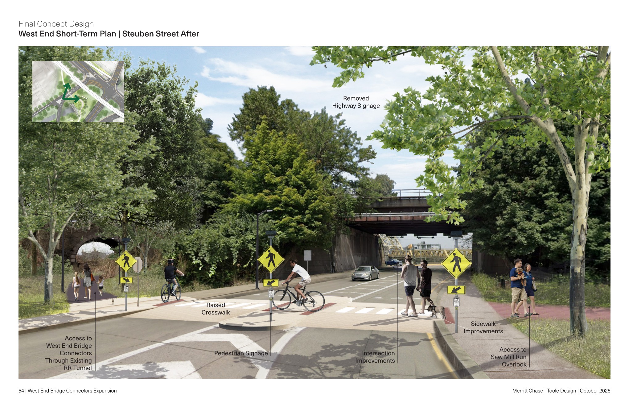
This conceptual rendering shows one potential alternative for improved pedestrian experience on Steuben Street.
Station Square Gateway
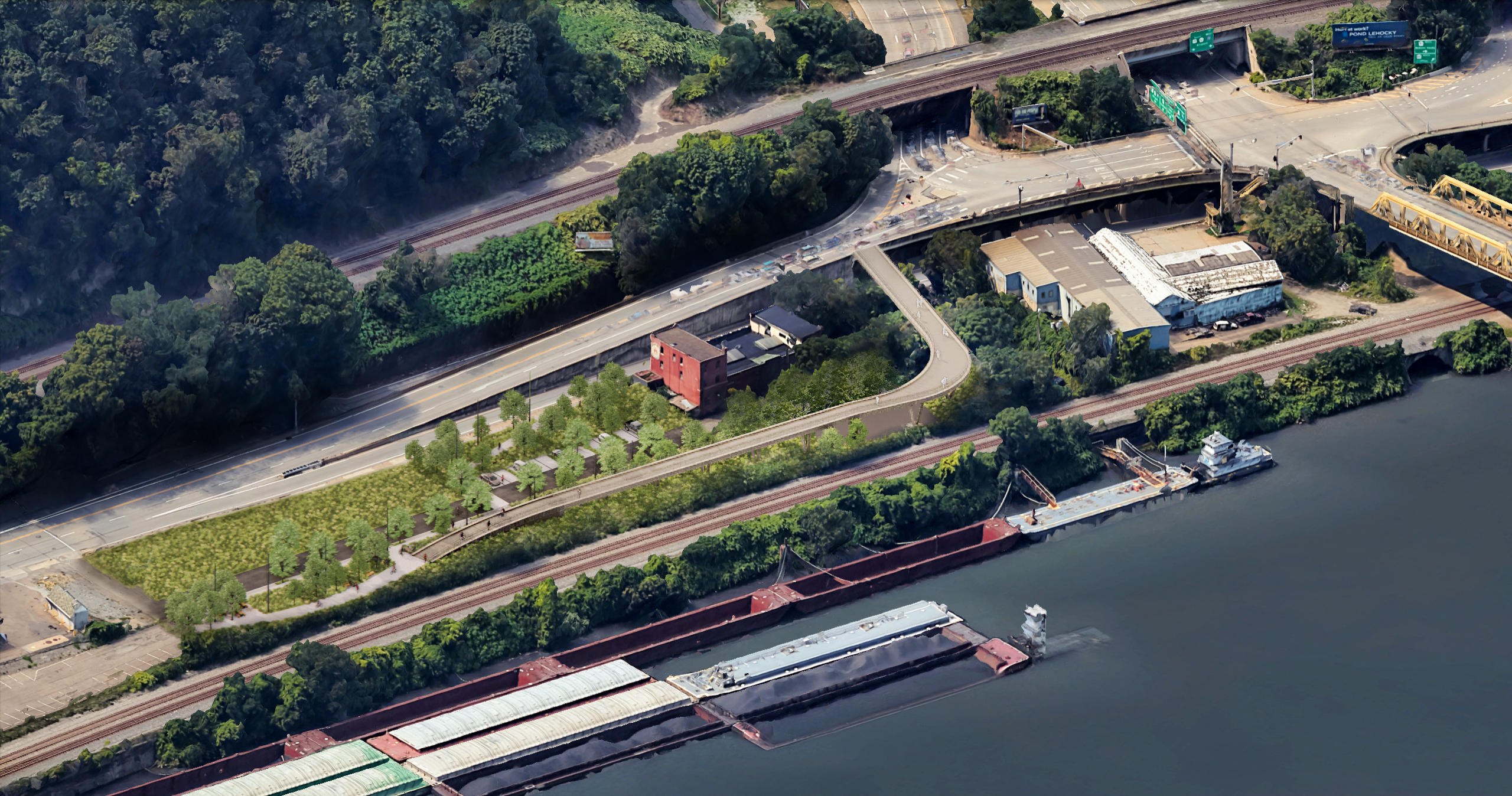
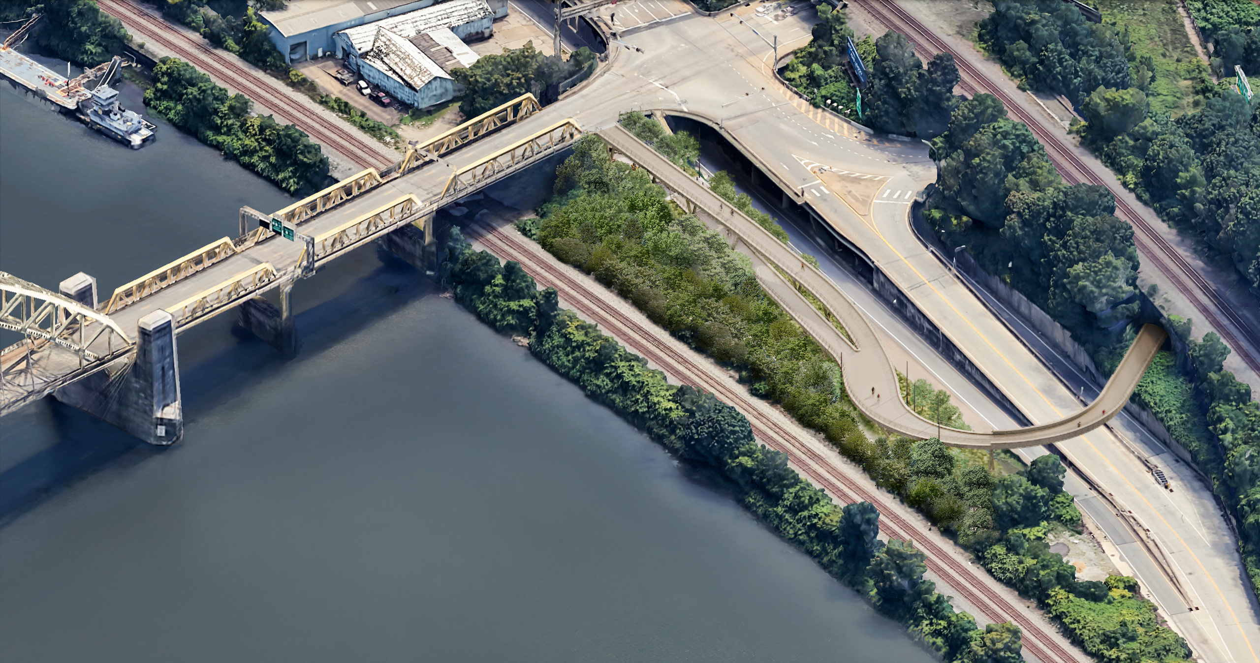
The access structure at Station Square Gateway runs parallel to the Ohio River with a long approach from Carson Street to meet ADA standards and turns at a right angle to connect with Carson Street and the West End Bridge.
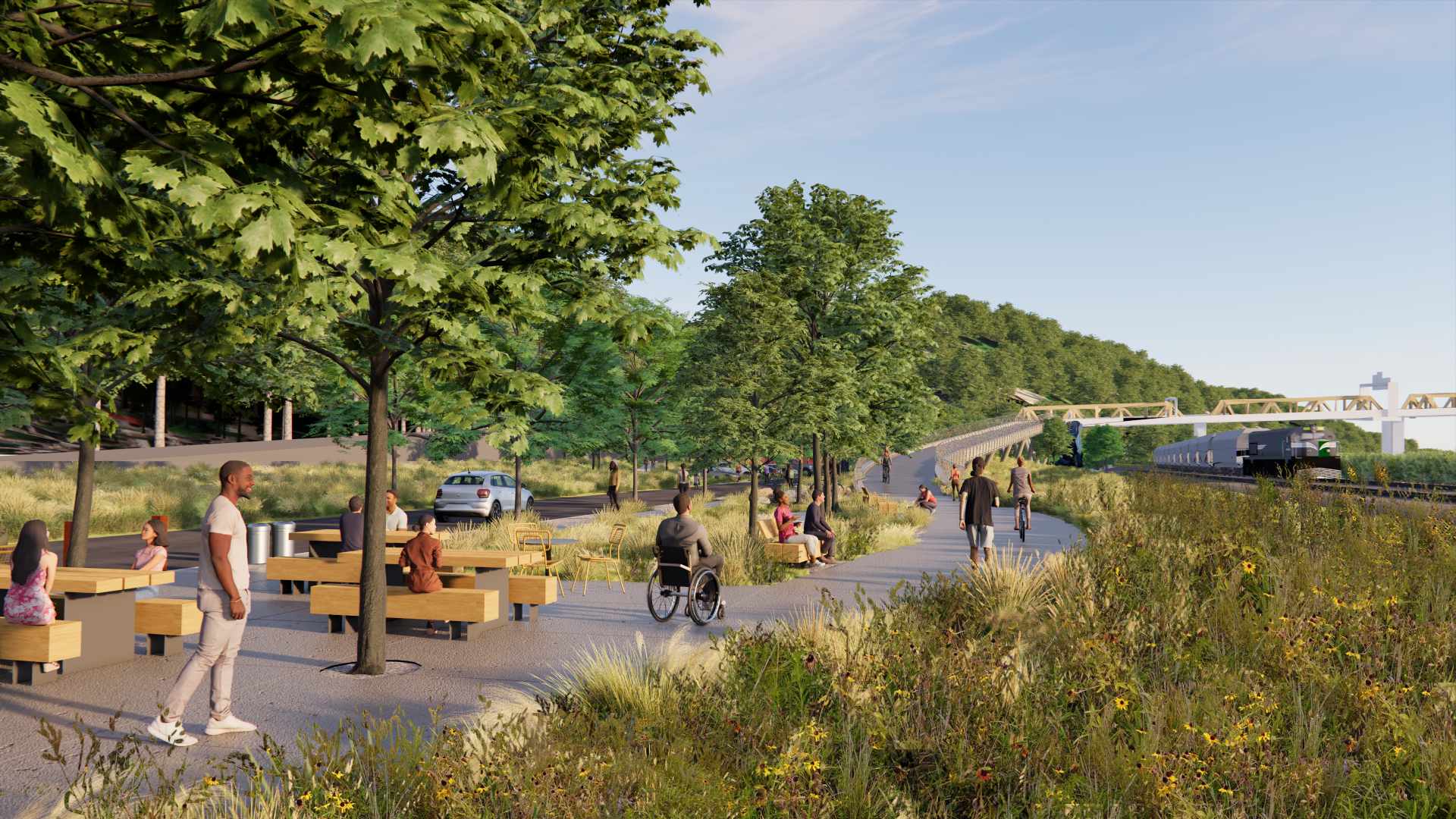
Station Square Gateway will transform the area between Carson Street and the Ohio River for trail users and drivers by providing improved plantings and areas for sitting and gathering.
Manchester Gateway
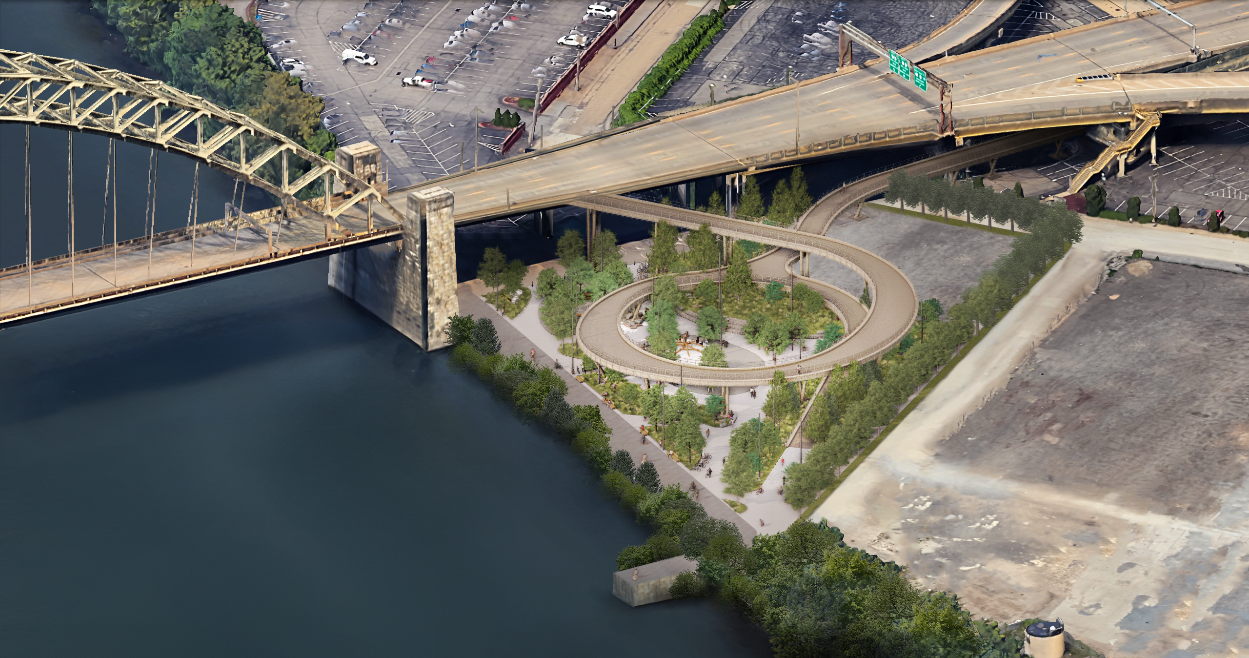
Manchester Gateway transforms the Ohio river front area downstream from the the North Shore with a spiraling access structure that defines a circular central plaza. With access to the Three Rivers Heritage Trail, picnic areas, nature play elements, and abundant new plants it could be a place for tranquil reflection or lively community gatherings like concerts and festivals.
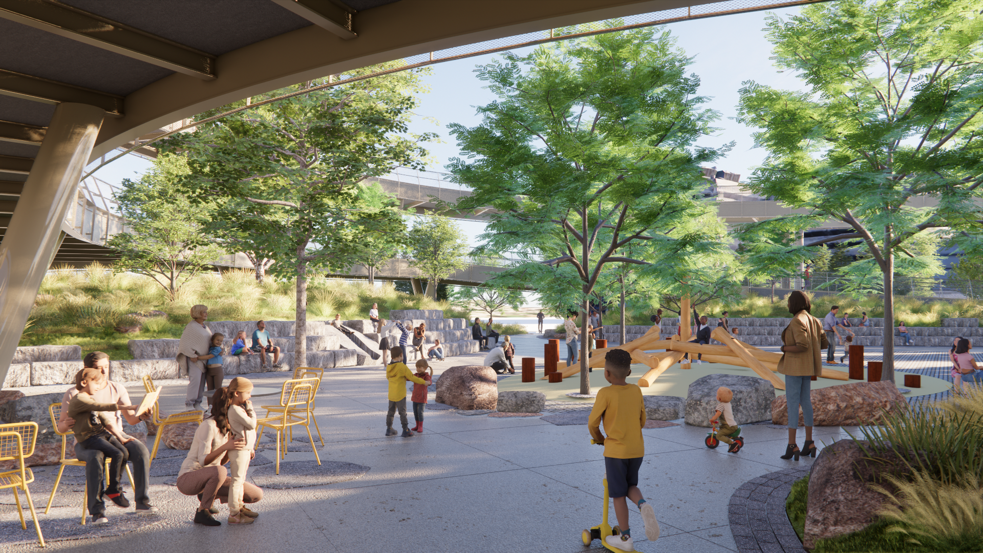
The large central plaza created by the spiraling access structure creates a place for rest, play, and socializing.
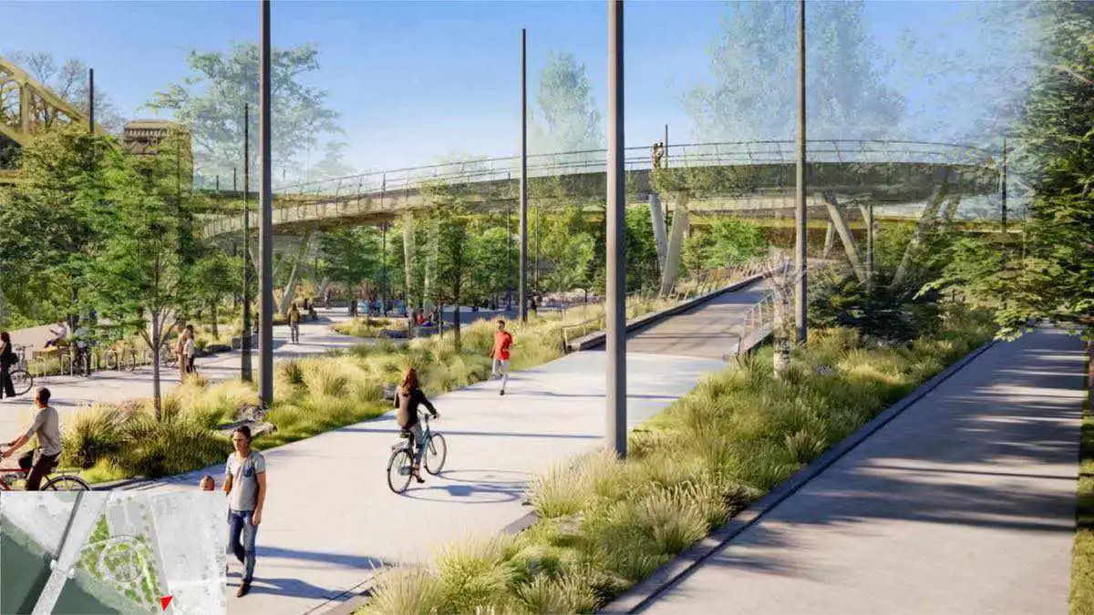
This image shows the view looking north from the Three Rivers Heritage Trail highlighting connection to existing trails and North Shore amenities.
Streetscape improvements will create safer pedestrian access to the West End Bridge, Riverfront Trail, and North Shore Amenities
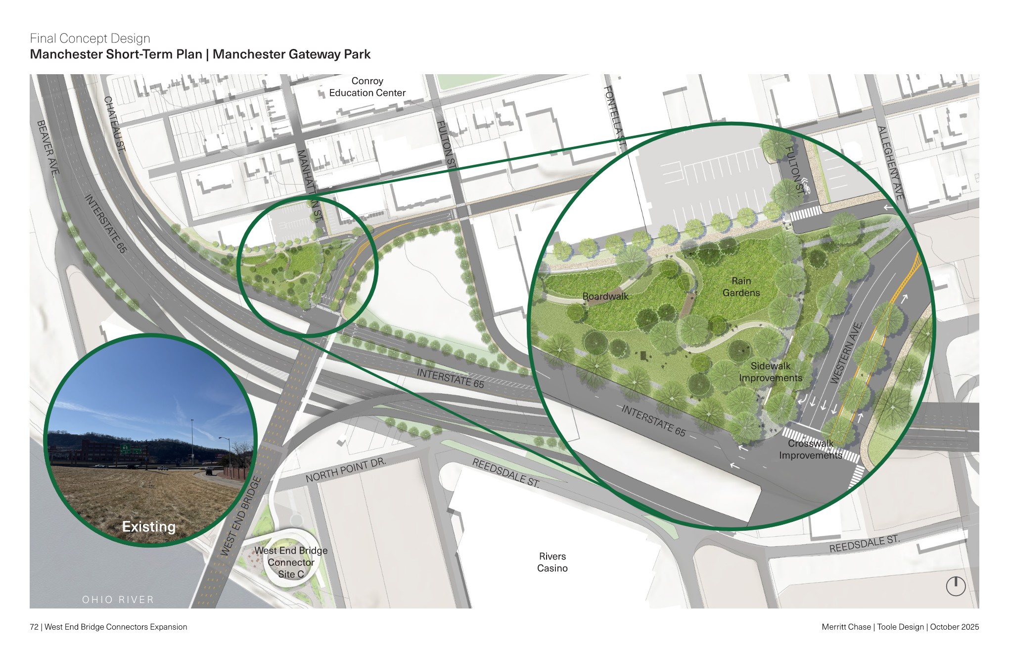
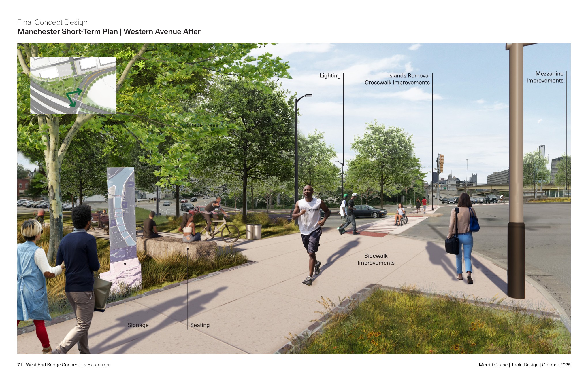
This rendering shows potential streetscape improvements creating a more enjoyable and safer pedestrian and bicycling experience between Manchester, the West End Bridge and the North Shore.
Public Engagement
March 13, 2024
Riverlife and El Dorado presented preferred designs for the proposed access structures at the West End Bridge, utilizing public comment to inform direction and goal setting.
Watch the full meeting by clicking the video below. Presentation documents can be located in the "Document Library" on this project page.
December 5, 2023
Riverlife hosted two community meetings to discuss three conceptual designs along with potential programming and landscaping designs based on feedback received from the community.
Click below to view a video of the full meeting.
April 6, 2023
Riverlife, along with Manchester Citizens Corporation, hosted an action-packed community meeting detailing plans in various development phases spanning from the Kamin Science Center to the Esplanade Project just down stream of the West End Bridge.
Project architects with El Dorado presented the current preferred designs of the accessible structures to connect the West End Bridge to the river path below.
View the full meeting by clicking the link below.


